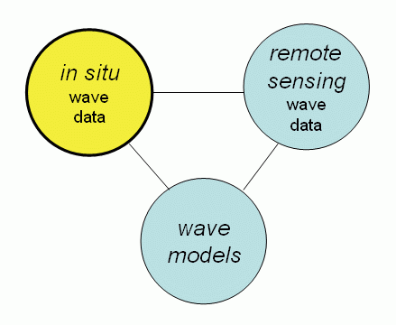
Welcome to the CDIP in situ Wave Data Support Page for
the GLOBWAVE user group.
The Coastal Data Information Program (CDIP) is based at Scripps Institution of Oceanography (SIO) in La Jolla, CA, USA.
CDIP is run by SIO oceanographers and collects in situ directional wave measurements for science and engineering applications using a fleet of Datawell Directional Waverider buoys.
For more information click on the Globwave product.
CDIP Data Holdings for GLOBWAVE Applications
CDIP maintains a number of directional wave stations at the edge of the continential shelf which are of potential value in GLOBWAVE studies. The goal in positioning these Datawell buoy stations was to place them in as deep a water as possible while still maintaining line-of-sight FM transmission of data to a shore station. With the recent addition of Iridium capability in newer Datawell buoys, we are no longer limited by line-of-sight and we will expand further offshore as dictated by scientific needs. The shelf-break placement of wave buoys is part of a larger US National Wave Measurement Plan to better integrate measurements with global, regional and nearshore models across the continental shelf to the shoreline.

The purpose of placing the buoys in deep water is to measure waves approaching the coast prior to their refraction and shoaling across the shelf. However, this can be a challenge for very long period/wavelength waves. A mooring maintenance cost/benefit trade-off typically results in deployements in 180-300m water depth depending on many logististal factors (bottom slope, shipping traffic, bottom trawling, etc).
Many buoys (both CDIP and NDBC) are often assumed to be in deep water for all wave periods, but in fact most are not technically in deep water for swell, and refraction effects can be significant when the swell approach the shelf at highly oblique angles. The depth of a buoy station, and its directional exposure to the open ocean, must be considered when interpreting spectral data.
Below is a table listing CDIP's primary open ocean shelf-break buoys.|
CDIP ID |
NOAA ID | Name | Lat | Lon | Depth | Years Operational |
| 139 | 46229 | Umpqua OR | 43.770 | 124.551 | 186m | 2006- |
| 094 | 46213 | Cape Mendocino CA | 40.292 | 124.739 | 319m | 1999- |
| 157 | 46239 | Big Sur CA | 36.338 | 122.101 | 366m | 2008- |
| 029 | 46214 | Pt Reyes CA | 37.946 | 123.470 | 550m | 1996- |
| 071 | 46218 | Harvest (Pt Conception) CA | 34.456 | 120.783 | 549m | 1998- |
| 067 | 46219 | San Nicolas Isl. CA | 33.222 | 119.883 | 335m | 1996- (many gaps) |
| 191 | 46232 | Point Loma South CA | 32.567 | 117.445 | 1123m | 2006- |
| 106 | 51201 | Waimea Bay HA | 21.672 | 158.115 | 200m | 2001- |
| 121 | 52200 | Ipan Guam | 13.352 | 144.788 | 200m | 2003- |
| 431 | 41140 | St Croix, V.I. | 17.768 | 64.725 | 255m | 2008- |
There are additional CDIP buoys in water depths of 180m+, but these are in locations that are significantly sheltered by islands (some may be of use in testing the viability of remotely sensed wave fields for assessing regional wave sheltering effects). In addition, CDIP has collected wave data with a variety of other types of instruments over the years, but their locations, depths, or limited frequency range of valid wave information, precludes us from recommending these data sets for GLOBWAVE applications. A complete listing of past and present CDIP stations can be found on our full station listing page.
An Introduction to In Situ Directional Wave Observations
Outline
1. The Dream:Accurate 2D wave spectra,
everywhere, all the time.
2. The Reality:What most wave instruments are
trying to measure, and what this tells us about the 2D spectra.
3. The Good, The Bad, and the Ugly: A recipe for choosing wave observation methods that meet stakeholders needs.
1. The
DreamAccurate
2D wave spectra, everywhere, all the time.
The perfect regional wave observation network would provide accurate estimates of 2D wave spectra at any time and location within the region, where 2D spectra are defined as wave energy S, as a function of wave frequency, f, and wave direction, θ.
S(f,θ,lat,lon,t) (1)
The wave field you visually observe at any time and
location is generally conceptualized as the linear sum of an infinite number of
underlying component waves that span all possible wave frequencies, and
arrive from all directions.Each
component wave is independent of the others in a completely linear wave field
(each component has a random phase relative to the others), and its amplitude
is defined by its 2D spectrum volume, S(f,θ)dfdθ.In practice, scientists and engineers
work with discrete approximations of S(f,θ), and a finite number of wave
components in frequency-direction bins with amplitudes, S(f,θ)∆f∆θ.
Present day wave research, and applied wave modeling,
focusses on S(f,θ) and how it evolves in space and
time.While many important wave data
users (eg. mariners) often focus on
reduced wave parameters, like significant wave height and the dominant wave
period, the accurate prediction of these parameters at all locations and times
is dependent on our ability to observe the behavior of S(f,θ).
For example, in Hawaii, California, and Southeast Florida, island sheltering plays a large role in the regional wave climates.Accurate observations ofS(f,θ) are needed offshore of the islands to model the sheltering effects correctly.
For regions with broad, shallow shelves, like the Mid-Atlantic States, bottom dissipation and scattering broaden the directional spread, and decrease the overall amount of wave energy in S(f,θ) at the coast in some situations.As a result, the ability of the waves to drive alongshore currents, move sediment, and generate dangerous rip currents, can also be sharply reduced, but our ability to predict these situations accurately depends on our ability to observe S(f,θ).
Finally, along more open but geographically complex coastlines (eg. New England, Northern California, Oregon , Washington) that have many headlands and partially protected coves, different sections of coastline are exposed to different wave directions.It is often the secondary or tertiary wave events present in the observed wave field that are most important at the sheltered locations most frequented by recreational beachgoers and mariners seeking shelter, and to predict waves at these sites with any skill, you need to know S(f,θ).
2. The
RealityWhat
most wave instruments are trying to measure, and what this tells us about the
2D spectra.
In situ wave observations typically involve the concurrent measurement of 3 time series:
1)The sea surface vertical displacement (z)
-OR-
vertical water particle velocity (dz/dt)
2) & 3) The sea surface horizontal displacement (x,y)
-OR-
horizontal water particle velocities (U=dx/dt, V=dy/dt)
-OR-
sea surface slopes (dz/dx,dz/dy)
.
These properties are either measured by a surface buoy or by subsurface instruments, and they can be acquired using a variety of sensor technologies, including pressure sensors (z, dz/dx, dz/dy), accelerometers (x,y,z), tilt and angular rate sensors (dz/dx,dz/dy) and acoustic transducers and receivers (z, dz/dt, dx/dt, dy/dt).Buoys that measure x,y,z are
called translational buoys, and buoys that measure z, and sea surface slopes dz/dy, and
dz/dx are called pitch-roll buoys.Subsurface instruments that measure horizontal wave orbital velocity components, U and V, are often referred to as PUVs, where P refers to using a pressure sensor to measure z.
So how are these 3 time series related to the S(f,θ) dream?
A fast Fourier transform (FFT) of the vertical displacement time series, z, yields an estimate of the wave energy, or sea surface variance, as a function of wave frequency,
S(f), or the wave frequency spectrum.
In addition, at a fixed frequency, f, the directional distribution of wave energy, S(θ),
can be expressed as an infinite Fourier series,
S(f,θ)=S(f)[a1 cos(θ)+b1 sin(θ)
+a2 cos(2θ) +b2 sin(2θ) +a3 cos(3θ)+b3 sin(3θ)+
a4 cos(4θ)+b4 sin(4θ)+](2)
Where a1, b1 , a2, b2, a3, b3,. are normalized directional Fourier coefficients with
values that range between -1 and 1.The term [a1 cos(θ)+b1 sin(θ)] is referred
to as the first moment of the directional spectrum, the a2 & b2 term the second moment, etc.
It is convenient to express S(θ)
in this form because the covariance of the vertical time series and the two
orthogonal horizontal time series (the co- and quadrature
spectra, or cross spectral matrix)are
directly related to a1,b1,a2 and b2.We'll avoid going into the time series
analysis details here, but the important thing to understand is that most in
situ directional wave instruments, no matter how accurate, only provide
estimates of the lowest order moments of the full directional spectrum at a
given wave frequency: a1, b1,
a2 and b2.
It is possible to estimate higher directional moments with additional concurrent measurements of the sea surface or velocities with a known spatial separation.For example, the linear pressure sensor array at the Army Corps FRF in Duck, NC, and acoustic doppler instruments with more than 3 beams.However, we will focus here on a1, b1, a2 and b2, as these have historically been challenging enough to measure accurately on a routine basis.
So what can you do with the low order directional Fourier coefficients a1,b1,a2,b2?
There are several options, including:
1)The measured directional fourier coefficients can be used to derive 4 estimator-free statistical parameters ofS(θ),
-mean direction
-spread
-skewness
-kurtosis
without additional assumptions.
2) The measured directional fourier coefficients can be used to constrain a directional estimator (eg. MLM or MEM), which guesses at the remaining infinity-2 directional moments in Eq. 2 based on some beauty principle (eg. smoothness or narrowness) to produce an estimate of S(θ).
3)The second moment directional fourier coefficient, b2, calculated in adirection reference frame relative to the shoreline normal, can be used to estimate the alongshore radiation stress, Sxy~ S(f)*b2(f).Sxy is a critical parameter for initializing alongshore current and sediment transport models.
Directional buoys and subsurface PUV-type instruments are all technically low resolution directional devices, no matter how accurately they measure a1, b1, a2, b2. Nevertheless, accurate instruments do resolve the most important features of the underlying directional wave spectrum in many situations, and contribute greatly to both applied wave prediction problems as well as our scientific understanding of wind-wave generation, propagation, and evolution in shallow water.
CDIP's experience with carefully tested and calibrated directional wave instruments suggests that useful estimates of S(θ) can be made with a1, b1, a2 and b2 when the directional spectrum at a given wave frequency has a single peak (unimodal) that is either symmetric or skewed, or two peaks (bimodal) that are both approximately symmetric but can have different sizes. Their usefulness decreases when the underlying directional spectrum becomes more complex, such as a bimodal distribution where one or both peaks are significantly skewed, or distributions with more the two peaks (eg. complex swell conditions inside island groups).Because we are only observing the lowest order directional moments of the wave spectrum, it is critical that a1,b1,a2 and b2 be measured accurately for any research or practical applications which rely on estimating the underlying component waves, or individual wave events, that are present in the regional wave field.
3. The
Good, The Bad, and The UglyA
recipe for choosing wave observation
methods that meet stakeholders' needs.
Stakeholder use of directional wave observations has historically fallen into 2 catagories:Those interested mostly in a few parameters of the wave field that approximately describe the dominant waves, and those interested in the underlying component waves or wave events.
The dominant wave users typically look at the
significant wave height, Hs, peak wave period, Tp,
and the mean wave direction at the peak wave period, Dm @ Tp.
These users are generally tolerant of modest errors in Tpand Dm, particularly when
Hs is small. There are likely few, if any, directional wave instruments currently in use that cannot adequately satisfy this user base.
The component wave users are more interest in observing the individual wave events in a region, or the wave energy in a particular f-θ range of the 2D spectrum S(f,θ). These stakeholders include scientists, engineers, surf forecasters, and increasingly, marine weather forecasters in regions where only describing the dominant wave conditions is inadequate for marine and beach safety.Instrument accuracy is far more important to component wave users, and the selection of directional wave instrumentation requires a more careful evaluation of its performance than what is commonly provided by manufacturers.
The bottom line: signal-to-noise
Whether or not a directional wave instrument is suitable for your regional observation
network boils down to its ability to measure 5 things:
1) Wave energy, S(f), and
2)-5)The Fourier directional coefficients a1(f), b1(f), a2(f), b2(f),
At all wave frequencies of interest, which in turn rely on the instrument measuring accurately the 3 time series described in section 2, including maintaining the correct x,y,z,reference frame while doing so.
There are numerous ways that errors can be introduced into the measured time series, but the most common issue we have encountered when evaluating instruments is noise. More specifically, the signal-to-noise ratio (SNR) of the wave sensor output, and its impact on the resulting estimates of S, a1, b1, a2, b2.As in high quality audio equipment, directional wave instruments can be defined by their fidelity.Instruments with high fidelity can be used to resolve some of the finer details of S(f,θ), like the directional width of spectrum at a particular wave frequency, and can more easily determine if the directional spectrum is bimodal or not. Low fidelity instruments will often return reasonable estimates of the mean wave direction (which is relatively insensitive to noise when the underlying spectrum is ~symmetric), but will overpredict directional spread, and underpredict skewness and kurtosis. The resulting biases in estimates of S(f,θ) can seriously impact the utility of the data in wave research and applied modeling applications.
SNR levels are a function of:
1) What aspect of the passing waves you are trying to measure (eg. sea surface displacement signals are often bigger than sea surface slope signals).
2) Wave energy (more energy = bigger signal)
3) Wave frequency (the lower the frequency, the lower the acceleration and velocity signals).
In general, the lower the wave frequency, and the lower the wave energy, the lower the SNR, and the poorer the directional wave measurements.Or stated another way,
small, long period waves are the most difficult to measure accurately owing to lower SNRs the measured wave variables. A well designed directional wave instrument has sensors whos response has been optimized to maintain as large a SNR as possible at low wave frequencies.
In Situ Wave Data Quality Control and Quality Assurance
Note: The opinions below are CDIP's, and are not intended to represent any official US IOOS or International JCOMM opinion. As oceanographers involved in wave research, our goal is to advocate for the collection of the highest quality wave data possible, and to promote the development of lower-cost wave measurement technologies without sacrificing data quality.
CDIP is an active participant in both US (IOOS) and international (JCOMM) efforts to establish standards for in situ wave data accuracy, instrument intercomparisons and evaluation, and data quality control.
In situ wave measurements broadly fall into 2 catagories: Oceanographic Quality (OQ) measurements, and Navigational Quality (NQ) measurements. We also believe GLOBWAVE will primarily benefit from Oceanographic Quality datasets in its pursuit of a more integrated approach to measuring and modeling waves.
Oceanographic Quality Measurements
Oceanographic quality non-directional wave instruments can accurately measure the wave energy at each wave frequency, f, of interest: a0(f). (nominally f=0.03-0.50Hz).
OQ directional wave instruments can accurately measure the .First 5. terms of the Fourier series that describes the directional wave spectrum at each wave frequency, f, of interest: the wave energy a0(f), and the first 4 directional Fourier coefficients, a1(f), b1(f), a2(f), b2(f). These 5 parameters can either be used directly to estimate the mean direction, spread, skewness and kurtosis of the underlying directional distribution at each frequency, or fed to a directional estimator (eg. MLM or MEM) to estimate a continuous directional spectrum.
Navigational Quality Measurements
Navigational quality wave instruments can accurately measure integral properties of the wave spectrum, such as the significant wave height, Hs, and mean wave period, Tm. In addition, NQ directional instruments can usually return accurate estimates of mean wave directions [ arctan of b1(f)/a1(f) ] at the more energetic wave frequencies in a spectrum. However, overall First 5 accuracy is low owing to poor sensor signal/noise ratios at some wave frequencies and/or poor wave-following characteristics of the instrument platform.
Differentiating between OQ and NQ wave measurements is not always easy. Wave instrumentation accuracy is strongly frequency and energy dependent, so it is common to have an instrument that performs well for high frequency waves, and is an OQ buoy in lakes and estuaries on windy days, but performs poorly at low wave frequencies and is a NQ buoy for swell in the open ocean.
OQ measurements, at all wave frequencies of interest to wave data users, are difficult to make from "multi-use" platforms because of complex and difficult to quantify hull response transfer functions. As a result, CDIP uses the "waves-only" Datawell buoys exclusively, and NDBC has been developing a waves-only buoy to deploy in tandem with its NOMAD platforms. Waves-only buoys are better wave followers and yield more accurate First 5 measurements when equipped with high quality motion sensors.
Historically, most government marine weather programs have understandably focused on NQ wave measurements, and wave forecast models and spaceborne wave monitoring have primarily used NQ data for validation. However, as models and remote sensing methods have improved, there has been an increasing interest in OQ datasets and, unfortunately, increasing over- or misinterpretation of details in NQ datasets by wave data users.
Most published wave instrument comparisons and gray literature circulated by instrument manufacturers evaluate the wave data at the NQ level, yet they routinely provide software for processed products that require OQ data, leading to further confusion in the wave data user community.
IOOS/JCOMM efforts to set wave data standards will allow the wide array of in situ instruments in use to be properly evaluated over time. While there is no officially agreed upon groundtruth instrument in the waves community, CDIP has performed co-located First 5 intercomparisons of Datawell directional waveriders (MK-II and MK-III) with a variety of different instruments over the years (pressure sensor array, several different non-adcp acoustic wave instruments, experimental gps buoys) and we are satisfied that it reliably returns OQ data over the broad range of wind-wave frequencies and energy levels of interest in our ongoing research program. The fundamental sensor technology used in Datawell MK-II and MK-III buoys has remained the same for over 20 years, making these buoys a reliable long-term benchmark, if not a groundtruth, for studying trends in the global wave climate.
The CDIP Approach to Wave Observation Intercomparisons
A wave component approach to evaluating directional wave instrument performance.
Our approach to evaluating a wave instrument is to stretch the traditional methods for representing wave frequency spectra as energy densities, and instead interpret the spectrum as wave components with different frequencies and heights, and ask the question How well can the instrument measure the underlying components of the wave field? As noted in section 1, a wave field consists of an infinite number on linear wave components, but for practical purposes, we discretize S(f,θ) into a finite number of wave components, each with a finite amount of wave energy, or a height.
Because directional wave instruments measure the frequency distribution of wave energy in much more detail than the directional distribution, we define wave components only by frequency, and then look at the ability of the instrument to measure estimator-free directional properties of each wave component (mean direction, spread, skewness and kurtosis) as a function of component wave height.
If we were to plot the difference between the measured components and a perfect groundtruth, we would expect to see something like the idealized Figure 1, if the only measurement errors were owing to noise.
Fig 1.
However, we have to modify this idealized view somewhat, because waves of a particular wave frequency can only grow so large before they break, so at each wave frequency, we would like to place on a limit on the possible height of that wave component. We can do this in a reasonable way by assuming an extremely large sea state (Hs = 20m, Tp = 20 s) and use the parametric JONSWAP frequency spectrum shape to define the maximum component wave heights we might ever expect to observe. To convert the JONSWAP spectrum energy density to maximum wave height components, we have to define a frequency bandwidth for our components, and we have chosen 0.01Hz. The resulting component wave height limit curve is show in Figure 2.
Fig 2.
Finally, in order to compare the test instrument and the groundtruth as a function of, we want to bin wave height ranges and gather enough samples in each wave component f-height bin to say something statistically significant about the differences between the two instruments as a function of frequency and height. Figure 3, shows our completed base plot of possible wave components we might observe and compare.
A Recipe for comparing two directional wave instruments, or model spectra and wave observations.
In this illustration, we are comparing data from instrument A to instrument B, and we are using instrument A as our groundtruth.
- Reduce data from both instrument #1 and #2 to hourly estimates of energy, and the 4 directional Fourier coefficients, in 0.01hz frequency bands from 0.03hz to 0.5hz.Creating a data table of the form:
- For each hour and each 0.01hz frequency band, place the instrument A & B data pair into predefined wave energy (component wave height) bins based on the wave energy measured by groundtruth instrument A. Figure 4 shows the result of sorting approximately 1 month of hourly data into wave component energy bins.f, that fell into the energy bin defined by the y limits of the box. As one might expect, we can see that in this month we have a lot of hours of observing high frequency (short period) wave components of all possible energies (wave heights), but no observations of high energy, low frequency components that would occur during more extreme wave events. An ideal comparison of two instruments would result in a large number of observations in all the bins below the extreme JONSWAP limit on the base plot. Such a comparison data set goal is unrealistic, however, this approach does allow for the development of guidelines for what constitutes a viable validation data set for an instrument.
- When the data sets have been binned in this way, we can see that even with just a month of data, there are quite a few frequency-height bins that have several hundred hours of observations from the two instruments, and we can calculate mean differences, rms errors etc., averaged over those N hours to get a statistically reliable estimate how well instrument B can measure the energy or a directional properties of those wave components compared to instrument A.


